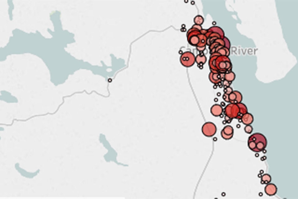
The corner of Highway 19A and Dogwood Street is the most crash-prone intersection in Campbell River.
The corner near Discovery Harbour Shopping Centre was the site of 60 crashes between 2013 and 2017, according to data from ICBC’s online crash map for Vancouver Island.
That figure included 25 so-called “casualty crashes” – those resulting in injuries or fatalities – and 35 other accidents resulting only in damage to property.
The runner-up for worst intersection during the 2013-2017 period was the corner of Dogwood Street and 2nd Avenue, which saw 58 incidents. Of that number, 23 involved casualties.
READ MORE: Pickup reached speeds up to 179 km/h before double-fatal crash on Vancouver Island
READ MORE: Driver airlifted to hospital following crash south of Campbell River
READ MORE: Loblaws apologizes after flipped semi-trailer closes highway south of Campbell River
The third most frequent site for traffic incidents in Campbell River was between intersections at various points along the Island Highway, accounting for 57 crashes from 2013 to 2017.
Of those incidents, 44 were casualty crashes, the highest figure in Campbell River.
ICBC noted that its maps don’t include crashes that took place in parking lots and involved parked cars. Crashes were only included if enough information was available to plot the exact location, and the data was current as of the end of March 2018, according to ICBC.
@davidgordonkoch
david.koch@campbellrivermirror.com
Like us on Facebook and follow us on Twitter