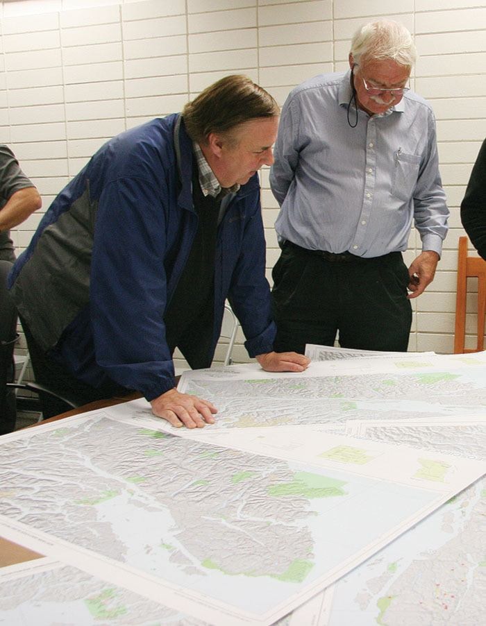
Like kids with treasure maps.
These are no kids though. These are men and a few women with technical degrees and long careers in mining, exploration and geo-science.
Still, they’re eager as children as they pore over several new maps which show the latest geochemical results for northern Vancouver Island.
“Masterful!” gushes Jacques Houle, a Nanaimo-based mining consultant who’s also president of the Vancouver Island Exploration Group. “I’ve been hoping to see this for 10 years.”
Houle is among the mining professionals who packed the Rivercorp boardroom in Campbell River Tuesday evening to get their first glimpse at the maps produced by Geoscience BC in partnership with the Island Coastal Economic Trust. The two contributed $930,000 for the Northern Vancouver Island Exploration Geoscience Project which included an airborne magnetic geophysical survey, stream sediment geochemical sampling, and a reanalysis of old rock and sediment samples that are permanently stored in Ottawa.
The end results are the new publically-available maps which are, in fact, actual treasure maps that are covered in “X” points.
“The chance of finding something is actually pretty good,” says Peter Kowalczyk, the project’s geophysicist.
Canada, he adds, does a fine job of producing regional data that greatly assists mining exploration. Updated data is available for much of B.C. and last summer it was time to re-map the North Island.
“This new scientific data…will help explorationists to generate new ideas and targets in this highly prospective area, and thereby provide new mineral resource development opportunities for the region and the province,” says Houle.
The airborne magnetic survey data was released in January and has already led to more than 16,000 hectares of new mineral exploration claims staked on the North Island. Now, with the release of the geochemical results, prospectors and mining companies can study all the data together. This allows more informed decision-making on where to look for gold, silver, copper and many other valuable minerals. “This new data will provide a key competitive advantage to North Vancouver Island communities and First Nations seeking to attract high-value investment in this region,” says Phil Kent, Mayor of Duncan and chair of the Island Coastal Economic Trust.
When the project was announced last year, former B.C. cabinet minister Pat Bell eagerly pointed to the benefits. Similar mapping was done previously in and around Smithers, a community of about 4,500 people, and that data generates ongoing exploration which employs hundreds of people and generates approximately $100 million annually in the region.
“Forget about a new mine for just now,” Bell said during a visit to Campbell River last July. “Last year, in B.C., approximately $460 million was spent on exploration.”
First Nations communities should also expect to benefit. “It’s nice to be involved from the ground up. Usually, the only time we hear about a mine is the first time they issue a permit,” said Dallas Smith, president of the Campbell River-based Nanwakolas Council which represents seven North Island First Nation bands. “This will bring opportunities to our communities.”
Rivercorp also partnered in the study and the data is instrumental in providing the long-term economic generators envisioned by CEO Vic Goodman.
“Business is all over what will happen in the next five years, but what about the next 10 or 20? This is what we’re looking at,” says Goodman, clearly pleased by the large and enthusiastic turnout. “We’re working on long-term business projects…and Campbell River is the hub for mining activity on the North Island.” View the data and maps at www.geosciencebc.com