After settling into a relatively mild January compared to a wintry December, Vancouver Island residents shouldn’t pack away their winter gear quite yet.
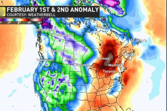
According to The Weather Network, by the start of February, a pattern reversal will bring much colder weather back to western Canada for a few days, as warmer, mild air will surge east into Ontario and Quebec.
For Vancouver Island, that could mean nighttime temperatures at or below freezing to begin the month, and daytime highs reaching just 1 C.
RELATED: Poor visibility expected across Vancouver Island as fog advisory extended
According to Doug Gillham, a meteorologist with the network, mild weather will return to western Canada. However, looking into the second week of February, he noted it appears the weather pattern will make a second attempt at flipping around with colder weather returning.
The average high for this time of the year in the Comox Valley is 6 C, with a low of 0.5 C.
Despite warmer temperatures in January, Environment Canada has issued a dense fog advisory for Vancouver Island for nearly a week.
The weather agency is warning residents that areas of dense fog will remain poor throughout the day Thursday (Jan. 27). Conditions continue to be favourable for fog to redevelop throughout the evening.
Visibility may be significant and suddenly reduced to near zero, the agency notes. If visibility is reduced while driving, slow down, watch for tail lights ahead and be prepared to stop.
photos@comoxvalleyrecord.com
Like us on Facebook and follow us on Twitter
