Open, controlled burns are common during the spring and fall, but the public is often not aware in advance when and where they will be happening, so they often mistake the smoke seen from such burns as a sign of wildfire.
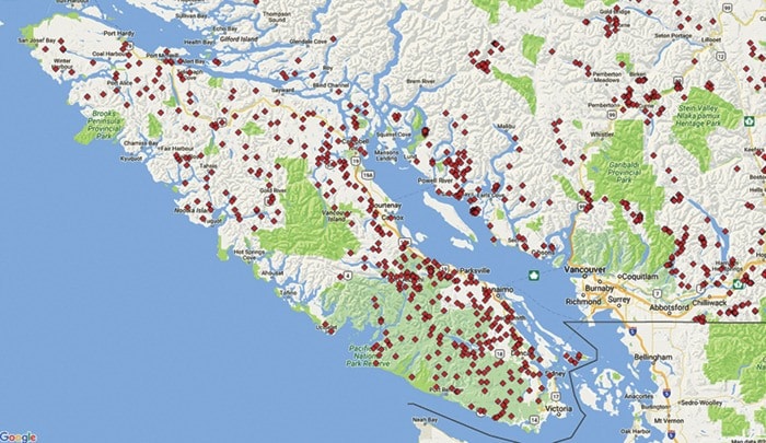
To help address this, the provincial government has an interactive map of registered Category 3 burns for the public to check when they see smoke.
A Category 3 fire is a fire burning material that is more than two metres high or three metres wide, stubble or grass more than .2 hectares in area or more than two piles of any size. These burns need to be registered with the Ministry of Forests, Lands and Natural Resources by calling 1-888-797-1717. Those registrations are then entered into the Open Fire Tracking System, which allows the BC Wildfire Service to map and track open burning activity throughout the province, and the public can, too, by using this interactive map.
Although wildfires are uncommon this late in the year, when in doubt, the public is urged to report smoke and flames by calling 1-800-663-5555 toll-free or *5555 on most cellular networks. Open fires can create significant amounts of smoke and appear to be quite intense (especially at night) even though they are burning safely within their planned boundaries.
For more information about safe open burning practices, head over to the BC Wildfire Service website.