Created with flickr slideshow.
How ‘bout that weather out there, eh?
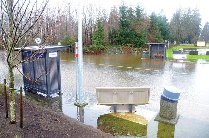
The series of recent weather systems drenching the region brought with them some issues.
Here’s a quick rundown of the situation with the two major waterways in the area as of the time the Mirror went to print:
The Campbell River
The Upper Campbell Reservoir is almost full, meaning BC Hydro may soon be unable to do anything to slow the flow of the Campbell River.
Due to the wet weather this week, according to Stephen Watson of BC Hydro, the reservoir rose 1.1 metres between Monday and Tuesday, and as of Wednesday afternoon was at 220.3 m. Once the reservoir level reaches 222 m – which it could easily do this week – all future inflow would be diverted directly into the already brimming Campbell River, as that is the maximum acceptable level to ensure dam safety.
Watson says that they are trying to release as much water as possible during low-tide periods to avoid bank damage downstream and in the estuary, but that “the high ocean tides each morning, and potentially outside of those times, will be very tricky to manage.”
He says that on Tuesday morning, for example, BC Hydro backed off power generation to minimum levels and reduced spill down Elk Falls Canyon, “and we just barely managed to keep the flows within the river bank at one low-lying area of the river.”
The City of Campbell River is warning residents along the river to take preventative measures to avoid damage to their property, expecting the high water to be an issue for up to two weeks after the systems pass.
Sand and bags are available through the city’s Dogwood Operations Centre. Those who need them should bring a shovel to 385 Dogwood St. and start filling bags.
The Oyster River
The Oyster River spilled its banks on Tuesday before continuing to rise, breaking its own previous flow records.
At 4:45 p.m. on Tuesday, The Oyster River flow below Woodhus Creek was running at 353 m3/s with a water level of 2.982 m, which, according to the Ministry of Forests, Lands and Natural Resource Operations, exceeded the maximum historical flow, which was previously 260 m3/s.
This flow level caused an upgrading of the previous Flood Watch to a Flood Alert for the area, including the Glenmore subdivision and tributaries of the Oyster River that affect the York Road area.
The Strathcona Regional District has arranged for people to get sandbags from Mike Oviatt Gravel Yard, located at 4771 Lewis Road (at the corner of Lewis and Hoover Roads), and is asking for people to report flooding to the district at 250-836-6700.
Road closures
Various road closures and barricading have occurred throughout the week, including, but not limited to: 16th Avenue near Nunn’s Creek Park, the intersection of Alder Street and 7th Avenue, Willis Road, the 14th Avenue and Cedar Street intersection, and the section of 12th Street between Dogwood Street and Greenwood.
Watch for updates as these systems taper off, and call the City at 250-286-4033 with any issues you see that they should be aware of in regards to water, sewer or road service.