The Campbell and Quinsam rivers and streams north of the City of Campbell River remain open to fishing despite the Level 4 drought rating being put on eastern Vancouver Island.
In response to low rainfall and record high temperatures across southern and eastern Vancouver Island, the province put residents on the highest drought alert and closed most streams and rivers to angling.
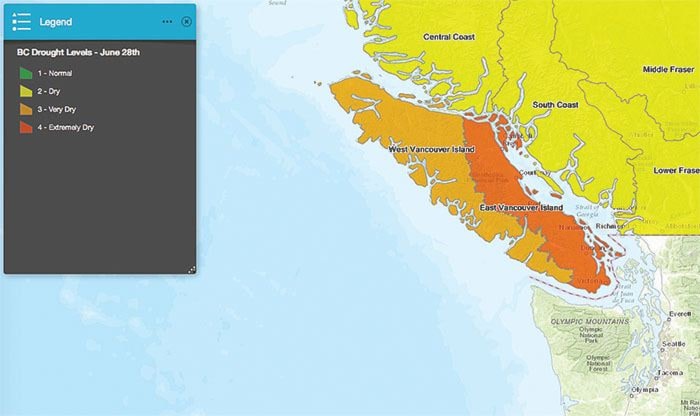
Government staff have upgraded the drought in the region to Level 4 – extremely dry – and are urging all water users – including residents, industry, farmers and municipalities – to reduce water consumption as much as possible. The area covered by Level 4 extends from north of Campbell River and the Discovery Islands down the east coast of Vancouver Island, and include Victoria, Sooke and Port Renfrew.
Areas north of Campbell River and along the west coast of Vancouver Island remain at a Level 3 drought rating, which means the conditions are very dry and water users should continue to limit their water use.
Meanwhile, the drought has lowered water levels and reduced flow in rivers and streams which is prompting the province to close down the freshwater sports fishery across much of the southern Island starting July 1.
Big Qualicum, Puntledge and Quinsam Rivers will remain open, along with Campbell River and all streams north of the City of Campbell River and Bamfield.
The fishing closures will remain in place until drought conditions improve significantly.
Quick Facts:
- B.C. has four levels of drought, with level 4 being the driest.
- Water restrictions such as sprinkling bylaws are usually put in place by the local municipal government, based on local water supply and provincial drought guidelines.
Learn More:
- Map of the drought-affected areas.
- Map of angling closure.
- To find out about water restrictions in your area, visit your local municipal government website.
- Learn about drought and water conservation in B.C.